Cao Bang to Ha Giang Motorbike Route: Northern Vietnam Loop Guide


Cao Bang and Ha Giang are usually sold as two separate trips. Riders do the Ha Giang Loop over three or four days, go back to Hanoi, and either stop there or return months later for Cao Bang. It works, but it involves riding the same 300 km of approach road twice, and it misses the best part of the Cao Bang to Ha Giang motorbike route.
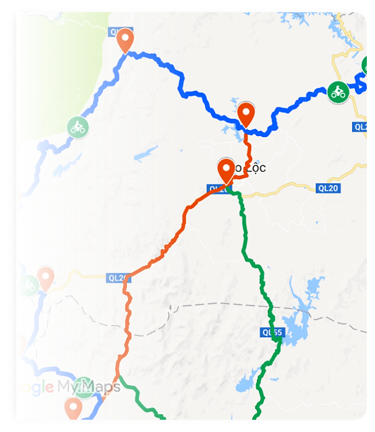
The Cao Bang to Ha Giang motorbike route joins them into one continuous circuit. Done properly it is six to eight days, it never repeats a road, and the connecting leg between the two provinces — the section almost nobody rides — is among the emptiest and most spectacular riding in Vietnam.
This guide is about the route itself: the stages, the distances, the realistic riding times, and where the days are longer than they look on a map.

Ban Gioc is the turning point of the loop — and the only major sight on the route that fills with visitors
Why ride the Cao Bang to Ha Giang motorbike route as one loop
Three practical reasons, beyond simply seeing more.
- No repeated roads. Ridden as a circuit — Hanoi north-east to Cao Bang, west across to Ha Giang, then south back to Hanoi — every kilometre is new.
- The connector is the highlight. The Cao Bang–Ha Giang link road through Bao Lac carries almost no traffic and no tour groups. Riders who do both provinces separately never see it.
- The two are genuinely different. Cao Bang is water and forest — waterfalls, caves, lakes, softer green hills. Ha Giang is bare rock — the Dong Van karst plateau, deep canyons, exposed passes. Back to back, the contrast is the point.
The Cao Bang to Ha Giang motorbike route, stage by stage
The circuit below runs anticlockwise from Hanoi over eight days. Seven is possible; six means cutting either Ba Be or the Cao Bang cave sites.
| Day | Route | Distance | Riding time | Surface |
| 1 | Hanoi → Ba Be Lake | 230 km | 6–7 h | Highway then mountain tarmac |
| 2 | Ba Be → Cao Bang town | 130 km | 4 h | Good tarmac, quiet |
| 3 | Cao Bang → Ban Gioc → Cao Bang | 180 km | 5–6 h | Sealed, some rough sections |
| 4 | Cao Bang → Bao Lac | 140 km | 5 h | Narrow mountain road, broken in places |
| 5 | Bao Lac → Meo Vac → Dong Van | 110 km | 5 h | The connector, then Ma Pi Leng |
| 6 | Dong Van → Yen Minh → Ha Giang city | 150 km | 5–6 h | Karst plateau, high passes |
| 7 | Ha Giang → Bac Ha or Tuyen Quang | 150 km | 4–5 h | Sealed river road |
| 8 | → Hanoi | 250 km | 6 h | Highway, straightforward |
Riding times, not distances, plan your day. On this loop 100 km can take five hours. Averages run 25–35 km/h on the mountain sections because of hairpins, surface and stops — not because the roads are dangerous. Planning by distance is how riders end up finishing in the dark.
Stage 1–3: the Cao Bang half
Hanoi to Ba Be
The first day is the least interesting and the longest. Clear Hanoi early — before 7am makes an hour’s difference — and the road improves steadily after Thai Nguyen. Ba Be is Vietnam’s largest natural lake, sits inside a national park, and is worth the extra 40 km detour over pushing straight to Cao Bang.
Ba Be to Cao Bang
A short, easy day on quiet tarmac through limestone hills. Use the spare afternoon for Nguom Ngao cave or the Cao Bang night market rather than adding distance.
The Ban Gioc day
Ban Gioc is the widest waterfall in Vietnam and sits directly on the Chinese border, which is why it is also the one place on this route with crowds and a ticket booth. Go early. The Ban Gioc waterfall route from Cao Bang runs 90 km each way through the Quay Son valley, and the valley road itself — bright green rice, limestone towers, water buffalo — is at least as good as the destination.
Nguom Ngao cave is 3 km from the falls and takes an hour. Combine them; almost nobody rides out here twice.
Stage 4–5: the connector nobody rides
This is the section that justifies the whole itinerary.
Cao Bang to Bao Lac runs 140 km on a narrow road that climbs and drops continuously through villages with no tourist infrastructure at all. The surface is mixed — good tarmac interrupted by broken stretches and the occasional landslide repair — and traffic is close to nil.
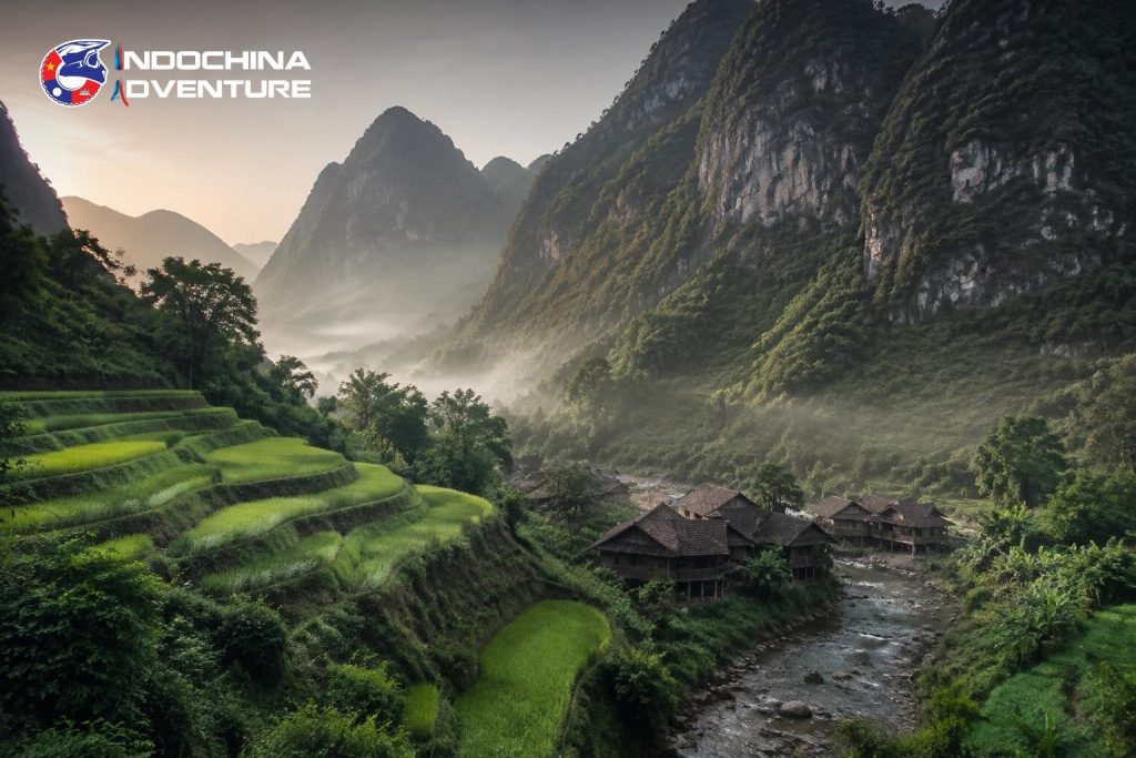
The Cao Bang–Bao Lac connector: no tour groups, no ticket booths, and the reason to ride the two provinces as one loop
Bao Lac is a small town on the Gam river and the natural overnight. From there the road climbs to Meo Vac and joins the Ha Giang Loop at its far end — meaning you ride the Ma Pi Leng Pass in the less common direction, towards Dong Van, usually against the flow of tour groups coming the other way.
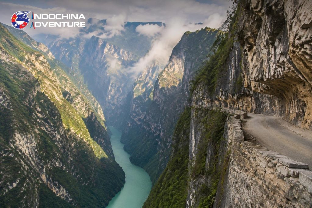
Ma Pi Leng: 20 km of road cut into the cliff above the Nho Que canyon, and the single most photographed stretch in the north
Stage 6: the Dong Van karst plateau
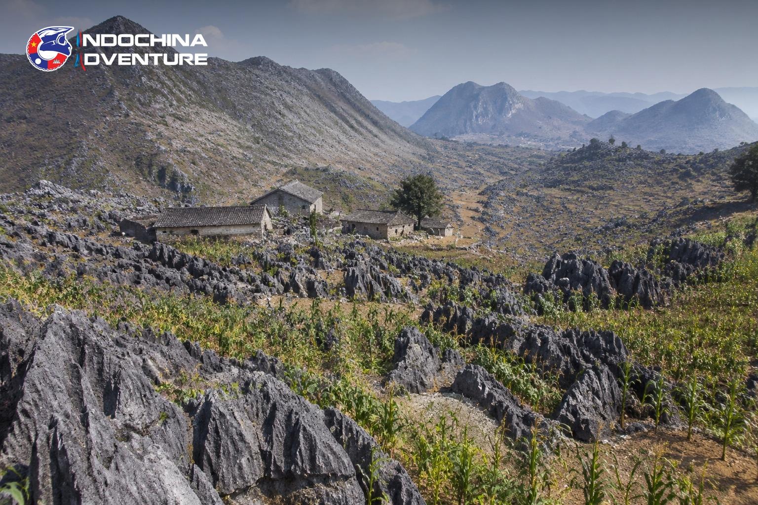
Dong Van to Yen Minh crosses a UNESCO Global Geopark of grey limestone spikes, and the landscape here is unlike anywhere else in Vietnam — bare rock with maize planted in whatever soil collects between the stones.
Worth stopping for: the Lung Cu flag tower at the northernmost point, the Hmong King’s palace at Sa Phin, and the Dong Van Sunday market if your timing lands right. It genuinely is a working market rather than a display, and it is over by mid-morning.
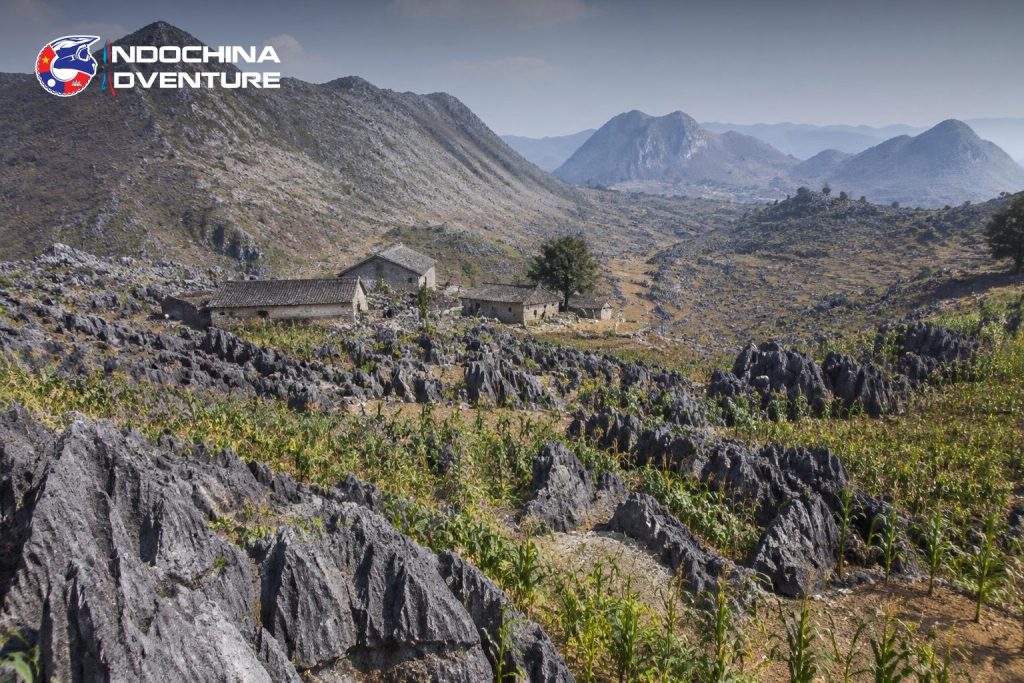
The Dong Van plateau: bare limestone with maize planted in whatever soil collects between the rocks
The Tham Ma and Bac Sum passes on the way south to Ha Giang city are tight, steep and the most technical tarmac of the trip.
Planning the Cao Bang to Ha Giang motorbike route
- Permits. A border area permit is required for parts of Ha Giang province and is arranged in Ha Giang city or through your operator. Ban Gioc needs a ticket, not a permit.
- Fuel. Fill in Cao Bang, Bao Lac, Meo Vac, Dong Van and Yen Minh. The connector day has the longest gap.
- Accommodation. Homestays throughout; Bao Lac and Meo Vac have the least choice, so arrive before dark rather than late.
- Weather. September to November is the best window — dry, clear, rice terraces gold. Month-by-month weather for Cao Bang is worth checking before you book. December to February is dry but 5–10°C on the plateau. June to August brings landslides on exactly the roads this route uses.
- Bike. A 150cc semi-automatic handles the whole loop. A manual 150–250cc is more comfortable on the hairpins and worth it if you can ride one.
Shorter and longer variants of the Cao Bang to Ha Giang motorbike route
Eight days is the complete circuit, but the route flexes in both directions.
| Length | What changes | What you lose |
| 5 days | Bus or transfer Hanoi–Cao Bang, ride Cao Bang → Ha Giang → Hanoi | Ba Be, and the first day’s riding |
| 6 days | Skip Ba Be, ride Hanoi–Cao Bang direct in one long day | A 230 km day becomes 280 km |
| 8 days | The full circuit as described | Nothing |
| 10 days | Add Bac Ha market and a Sapa leg on the return | Nothing — but the last two days are busier roads |
The five-day version is worth considering if your holiday is short. Transferring the Hanoi–Cao Bang leg removes the dullest riding on the route and costs you almost nothing scenically, which is not true of any other cut.
Can you ride the Cao Bang to Ha Giang motorbike route independently?
Yes, and plenty of people do. The considerations are the same as anywhere in northern Vietnam: you need the correct licence, the permits, and a bike you trust on the Bao Lac connector where help is genuinely far away.
The arguments for going guided on this particular route are the connector day and the permits. Both are solvable alone; both are the parts independent riders most often get wrong. Our Vietnam motorbike tours run this circuit as a seven- or eight-day route, with prices by length,, and riders continuing on to Laos usually join it to a crossing border motorbike tour through Tay Trang rather than returning to Hanoi.
Cao Bang to Ha Giang motorbike route: frequently asked questions
How many days do I need for both provinces?
Eight is comfortable, seven works, six means cutting Ba Be or the Cao Bang caves. Anything shorter is one province, not both.
Which direction should I ride the loop?
Anticlockwise — Cao Bang first, Ha Giang second. It puts the easier riding early, saves the karst plateau for last, and means you meet Ma Pi Leng travelling against the tour-group traffic.
Is the Cao Bang to Bao Lac road difficult?
Not technically, but it is narrow, continuously winding and has broken sections. It is a five-hour day for 140 km. Ride it in the morning and do not plan anything after it.
Do I need a permit?
For parts of Ha Giang near the border, yes — arranged in Ha Giang city or by your operator. Cao Bang province does not require one, though Ban Gioc has an entrance ticket.
When is the best time to ride?
September to November. Rice terraces are gold in late September, skies are clearest in October and November. Avoid June to August for landslide risk on the mountain sections.
Can I do it on a scooter?
A 150cc semi-automatic yes; a 110cc scooter is underpowered on the Bac Sum and Tham Ma passes and on the climbs out of Bao Lac.
Is it better than the Ha Giang Loop on its own?
It is longer and quieter. If you have four days, ride Ha Giang — our Ha Giang Loop or Cao Bang Loop comparison sets the two side by side. If you have eight, the combined loop shows you a side of the north that the standard loop does not reach.
Ridden separately, Cao Bang and Ha Giang are two good trips with a lot of repeated road between them. Ridden as one circuit, they become the best week of motorcycling in northern Vietnam — and the connecting leg through Bao Lac, which no itinerary sells on its own, is usually the day riders remember. Tell us how many days you have and the Indochina Adventure team will fit the route to them.


Latest posts
Cao Bang to Ha Giang Motorbike Route: Northern Vietnam Loop Guide
 Date: 20/09/2026

Cambodia Adventure Motorbike Tour: Angkor and Beyond
Date: 18/09/2026

Crossing Borders: The Vietnam to Laos Motorbike Paperwork Guide
Date: 16/09/2026
Bigbike vs Dirtbike Tours in Vietnam: Which One Should You Book?
Date: 12/09/2026
Laos Motorbike Tour: The Best Routes Through North and South Laos
Date: 10/09/2026
Maybe You Don’t Know
Cambodia Adventure Motorbike Tour: Angkor and Beyond
A Cambodia motorbike tour guide: Angkor, the temples beyond the park, the red dirt northern…
Date: 18/09/2026

Crossing Borders: The Vietnam to Laos Motorbike Paperwork Guide
What a Vietnam Laos border motorbike tour needs: visas, vehicle papers, which crossings take motorbikes,…
Date: 16/09/2026
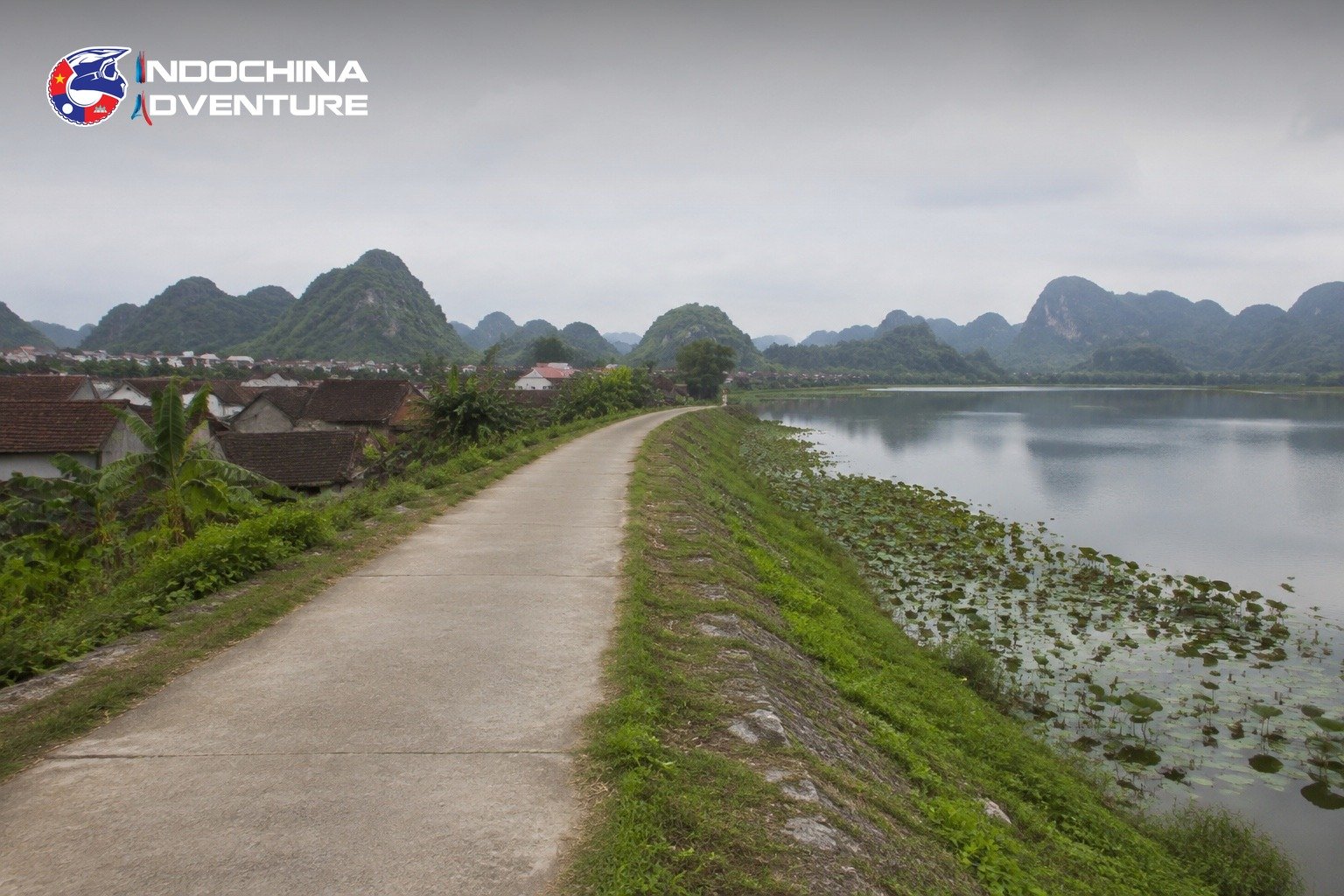
Ninh Binh by Motorbike: Tam Coc, Trang An and the Roads Most People Miss
A Ninh Binh motorbike tour guide: the Tam Coc and Trang An loop, the quiet…
Date: 14/09/2026
Bigbike vs Dirtbike Tours in Vietnam: Which One Should You Book?
Bigbike vs dirtbike tour Vietnam: an honest comparison of terrain, riding demand, comfort and cost…
Date: 12/09/2026
Laos Motorbike Tour: The Best Routes Through North and South Laos
A Laos motorbike tour guide covering the northern mountain loops and the southern Thakhek and…
Date: 10/09/2026
South-North Vietnam Offroad Motorbike Tour: Riding HCM City to Hanoi The Hard Way
Planning a Vietnam offroad motorbike tour from HCM City to Hanoi? Route breakdown, daily distances,…
Date: 08/09/2026